Fees
National Registration Fee : Nu. 7,000/-
SAARC Registration Fee : USD 165/-
Expat Registration Fee : USD 165/-
International Registration Fee: USD 250/-
Participants Receive
- Finisher’s medal for all finishers
- Finisher’s certificate for all finishers
- Participation certificate for all participants
- T-shirt for all participants
- Pre-race briefing in Bumthang
- Bike and participant transportation from Thimphu to the start line in Bumthang (as needed)
- Special awards to top finishers
- Awards celebration at Clock Tower Square, Thimphu
- Aid stations (aid station supplies will be announced before the race)
- Roving medical support
- Roving technical support
- Sweep vehicle for participants who must pull out of the event, or who do not make cut-off times.
ToD PRIZES
Tour of the Dragon cash purse and additional prizes will be offered to participants as follows:
| Men’s Division: |
Women’s Division: |
1st Nu. 150,000/-
2nd Nu. 95,000/-
3rd Nu. 75,000/-
4th Gifts worth: Nu. 10,000/-
5th Gifts worth: Nu. 10,000/-
6th Gifts worth: Nu. 5,000/-
7th Gifts worth: Nu. 3,000/-
8th Gifts worth: Nu. 3,000/-
9th Gifts worth: Nu. 3,000/-
10th Gifts worth: Nu. 3,000/- |
1st Nu. 150,000/-
2nd Nu. 95,000/-
3rd Nu. 75,000/-
4th Gifts worth: Nu. 10,000/-
5th Gifts worth: Nu. 10,000/- |
Youngest Rider to complete the race [must cross before cut-off time]: Nu. 10,000/-
Eldest Rider to complete the race [must cross before cut-off time]: Nu. 10,000/-
Course Information
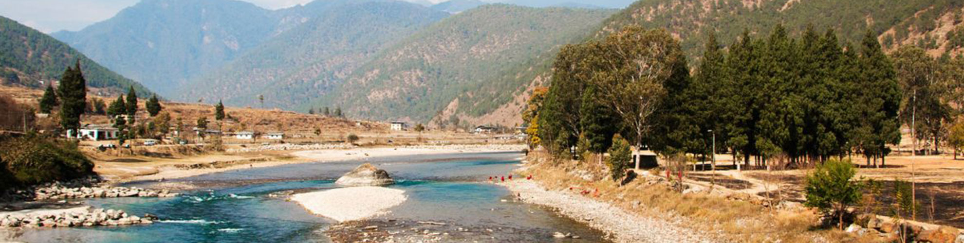
Tour of the Dragon starts in Bumthang, central Bhutan (2610 m, 8560 ft), and takes you to Thimphu across 4 mountain passes, or las as they are called in Dzongkha.The riders follow the Bumthang Chhu (river in Dzongkha) for a couple of kilometers and then climb 6 km through blue pine forest to Kiki La at 2870 m (9420 ft). From there it is down to Nangar. Through more blue pine forest and agricultural land you follow a gentle road through Chumey and up to Gaytsha (2950 m, 9680 ft).
The road then climbs 7 km up through blue pine forest to Bong Bridge, and then gets a little steeper for about 5 km through mixed conifer and rhododendron forests and pastures until you reach Yotong La at 3430 m (11250 ft). From Yotong La it is a 29 km downhill ride to Trongsa. The pass is dominated by fir and rhododendron forest, open pastures and rock outcrops. As you go down to Dorji Gonpa, which is almost halfway, firs give way to spruce and hemlock and mixed broadleaved forest dominated by birch and oaks and rhododendrons. Below Dorji Gonpa, the road passes though broadleaved forest and agricultural fields. There are some excellent viewpoints to see in Trongsa, including the dzong (fortress) and the extensive forests and agricultural fields beyond. Just before reaching Trongsa (2150 m, 7050 ft) you pass right below the Ta Dzong (a watchtower to guard the dzong from enemies).
From Trongsa the road descents gently for 7 km to the Bjee Zam bridge at 1900 m (6230 ft) and then climbs 6 km through broadleaved forest to a viewpoint from where the Trongsa Dzong seems just a stone’s throw away. The road continues climbing for another 10 km along cliffs and through broadleaved forests and agricultural settlements. At Tshangkha it passes the headquarters of the Jigme Singye Wangchuk National Park. After reaching Tashiling, a few km further, most of the climbing is done. For the last 20 km you will only climb some 150 m (500 ft), but there are some ups and downs. As you near Chendebji, hemlock replaces broadleaved species on some of the ridges and in the valley. You pass Chendebji Chorten and a little later will reach Chendebji village (2430 m, 7970 ft).
The road climbs through mixed conifer forest past Nikachu bridge at Chazam and Rukubji to the small settlement of Longte. By this time most of the trees have been replaced by pastures and agricultural fields. Through these pastures dominated by dwarf bamboo you reach Pele La (3430 m, 11250 ft). You then continue your long descent through fir, birch, rhododendron forest and many small waterfalls to Wangdue Phodrang. After passing the village of Nobding, there is a single restaurant a further 12 km down and then a few shops at Teki Zampa another 15 km further. Just past here a new Japanese bridge spans the Dang Chhu. At Chuzomsa, there is a side road to an abandoned slate mine. After a long, almost flat stretch you reach Wangdue Phodrang.
From Wangdue Phodrang, you continue to Metshina (1410 m, 4625 ft). From Metshina, the distance to Dochula at 3150 m (10,330 ft) is 38.3 km and the race is all uphill, with an average slope of 5% and a few short sections of up to 10%. You will pass Thinleygang (11 km), Lumitsawa (15km), Lampiri (28km), and a memorial chorten for traffic accident victims (32km). Thinleygang is the only place recognizable as a village, having a couple of shops and a BHU (Basic Health Unit). Racing 1700 m (5575 ft) uphill is as breathtaking as the views.
After Dochula, it’s all downhill to Thimphu at 2330 m (7640 ft), with a small climb only at the end to the Thimphu city square.
Course Details
| Start Point |
Elevation |
End Point |
Elevation |
Highest Point |
Distance |
| Jakar town |
2610m |
Gaytsha |
2950m |
Kiki la – 2870 |
27 km |
| Gaytsha |
2950m |
Trongsa |
2150m |
Yotong la – 3434m |
41 km |
| Trongsa |
2150m |
Chendebji |
2430m |
Near Chendebji – 2440m |
43 km |
| Chendebji |
2430m |
Wangdue Phodrang |
1200m |
Pele la – 3430m |
87 km |
| Wangdue Phodrang |
1200m |
Thimphu |
2330m |
Dochula -3150m |
70 km |
Aid Stations
Aid stations are located approximately 20Kms apart. Aid stations will feature water, fruit, and other nutrition that will be announced prior to the race start. There will be mile markers at each aid station.All riders are encouraged to carry a water bottle and any other necessary or needed personal food supplements between aid stations.
There will be six mobile aid cars roving along the route with food supplements basic medical kit and one technical personnel for minor bike repairs. You can get support at aid stations, but it is prudent to not count on the roving vehicles as it is impossible to know where they will be when you need them.
Traffic
Traffic will be open to vehicles, but will be monitored by local police and transportation officers. Most of this route is on the national highway in Bhutan, so vehicles will be on the roads.
Medical
Medical personnel will be available at the start and finish line as well as roving on the course. There will be an ambulance on standby.
Timing
There will be intermittent and undisclosed checkpoints along the course where you will check in with timing personnel. You will be given your finish time at the Awards Ceremony.
Climbing.
Bhutan is a land of high mountains and deep valleys, and the 270 km route demands 8,000 meters (26,000 feet) of climbing. This is completely absurd. The hardest stages of the Giro d’Italia or the Tour de France usually cover 5,000 meters (16,400 feet) of climbing in a day, and that is on ultra light, super fast road bikes on perfectly paved roads. So 8,000 meters of climbing is a massacre. It’s basically riding to the top of Mt. Everest from sea level. In a single day.
Altitude.
Tour of the Dragon is way up high in the Himalayas, with an average altitude around 3,000 meters (9,800 feet).
The road.
There are no flat spaces in Bhutan, and the mountains are extremely steep. The road is a feat of engineering carved out of the side of these majestic mountains. Since it was the end of monsoon season with lots of rain still falling, we were dealing with landslides and mud—a whole lot of mud. Then, there was the added danger of zero guardrails, so falling meant certain death. The entire course is without question, a no fall zone.
The weather.
Mountain weather is always unpredictable, especially during monsoon season. This was going to make the race even more difficult, as the temperature difference over the course of the day could be up to 70 degrees F (21 C) or more, including heavy rain. Selecting the right clothing is crucial, as you can overheat on the ascents and get so cold on the descents that you can’t feel your hands.
Bike Tech
It’s impossible to find bike parts in the middle of the Himalayas, You need to have everything with you, and on the bike. You will need a spare of everything such as tubes, tools, mech hangars, spare screws, a knife, zip ties, duct tape, lights for riding in the dark, spare tires and so on
Food.
The right food is 50% of a ride such as this. One also does not want to start switching food two weeks before or during the race. You need to bring medicines and supplements .
Clothing: Essentials
Velotoze rubber helmet cover
Velotoze rubber full length shoe cover
Merino neck gaiter
Windstopper headband
Knee covers
Arm warmers
Bibs and over-shorts
Merino jersey and shorts
Mesh undershirts
Cold weather jacket
Plastic thin rain jacket
Tech Essentials
Norco 29’er Hardtail MTB
Lights! Enough power for two nights
Sidi Dragon MTB shoes
Allen keys
Extra tires
Extra tubes
Vaseline
** Riders need to cross Dochula Pass by 6 pm. If not, the sweep team will pick you up. After the cut off time all resources such as volunteers, marshals, aid stations and officials will not be available to riders who insist on completing the race the rider after the cut off time.